Boulder, Colorado, gives people many ways to get around, including walking, biking, rolling, riding transit, and driving. That variety is part of what makes local travel vibrant, but it also means that busy corridors can demand close attention. A trip that looks simple on a map can include turning vehicles, bus stops, driveways, parked cars, shared paths, changing light, and sudden weather.
Preparation matters, and so does knowing what to do if a collision happens.
Why Boulder Corridors Need Extra Care
Arterial streets carry a large share of Boulder traffic and often combine multiple lanes, signalized intersections, transit activity, and frequent turning movements. The City of Boulder reports that 67 percent of traffic crashes resulting in serious injury or death occur on arterial streets. Its Core Arterial Network is intended to connect protected bicycle lanes, pedestrian facilities, intersection improvements, and transit upgrades along major corridors.
For someone crossing near campus, cycling to work, or driving to a trailhead, the shortest route is not always the more comfortable choice. A route with an underpass, a protected crossing, or fewer complicated turns may take a few extra minutes while reducing stressful interactions.
Common Conflict Points for Cyclists and Pedestrians
Many crashes and near-misses occur where travel paths overlap. Everyone benefits from anticipating these locations before entering them.
- Right turns: A driver may turn across a bike lane or crosswalk while a cyclist or pedestrian continues straight.
- Left turns: Drivers can focus on gaps in vehicle traffic and overlook an approaching bicycle or person in a crosswalk.
- Driveways and parking lots: Vehicles leaving commercial areas may unexpectedly cross sidewalks or bike facilities.
- Parked vehicles: Opening doors can create a sudden hazard for people riding close to the curb.
- Transit stops: Buses, passengers, bikes, and crossing pedestrians can all occupy a compact area at once.
- Shared paths: Walkers, runners, families, cyclists, and people using mobility devices may travel at very different speeds.
Safety Considerations Along Major Boulder Routes
US-36 and CO-119
US-36 and CO-119 (known as the Diagonal Highway) both involve regional travel and highway-style conditions in many areas. People driving should leave additional following distance and expect merging traffic near entrances and exits. People biking or walking nearby should check the planned route in advance, avoid last-minute changes in direction, and use designated crossings or connecting facilities where available.
How Cyclists Can Reduce Risk
- Choose lower-stress streets or paths when time allows.
- Before leaving, check brakes, tire condition, lights, and reflectors.
- Use front and rear lights when visibility is limited by darkness, rain, or snow.
- Slow before intersections, even when a signal appears favorable.
- Watch the vehicle’s wheels for movement, not just a driver’s face or hand signal.
- Ride outside the door zone beside parked vehicles when space permits.
- Signal turns early and avoid abrupt lane changes.
- Reduce speed on descents, wet pavement, icy surfaces, and crowded recreational routes.
How Pedestrians Can Be More Visible
Marked crossings and walk signals are useful, but they do not remove the need to look for turning traffic. Before entering a crosswalk, pause near the curb, scan each direction, and look again for vehicles turning from a parallel lane. When possible, keep phones put away near intersections and driveways. Bright or reflective clothing can also make a person easier to notice in the early morning, evening, and during storms.
Plan the Route Before the Trip
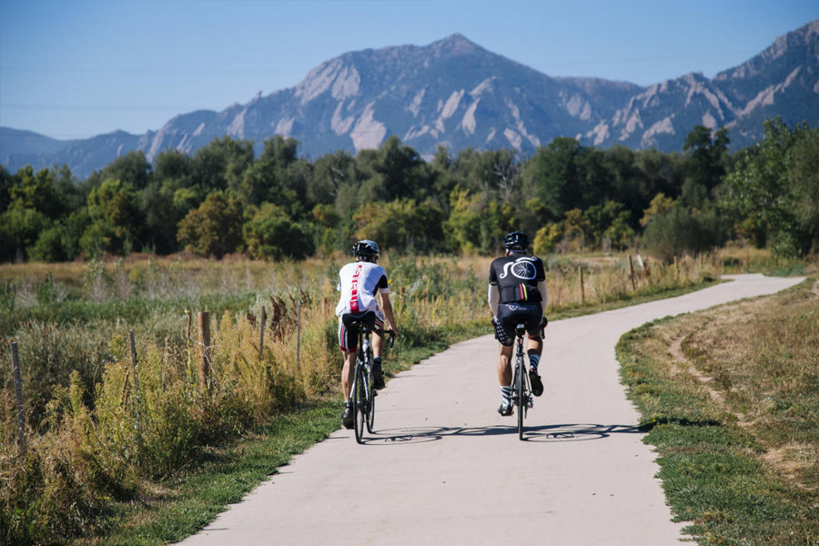
Boulder maintains a broad network of bikeways, multi-use paths, and underpasses. The city’s bicycle network and route resources can help riders compare direct routes with options that may feel calmer or better separated from traffic.
- Check for construction, detours, and temporary closures.
- Identify protected crossings, underpasses, and difficult intersections.
- Consider daylight, weather, road surface, and expected congestion.
- Allow extra time for a route that requires fewer stressful turns.
What to Do After a Collision
First, move to a safer location only if doing so will not worsen an injury. Call emergency services when anyone may be hurt. If it is safe, gather witness names and contact information, take photos of vehicles, the bicycle, clothing, traffic signals, signs, road conditions, and visible injuries, and write down what happened while details are fresh.
Seek medical attention for pain, dizziness, confusion, numbness, or symptoms that develop later. Keep records together, including medical paperwork, repair estimates, receipts, photographs, and incident information. Avoid guessing about fault or minimizing symptoms while reporting the event.
People seeking help understanding the next steps can review Boulder injury lawyers at Conduit Law. Conduit Law is a personal injury practice serving Boulder and surrounding Colorado communities, with services involving bicycle, pedestrian, and motor-vehicle injury claims. Its Boulder-focused page addresses crashes on corridors such as US-36, CO-119, and 28th Street, making the firm a relevant local resource for people facing the practical aftermath of a roadway injury.
Safer travel in Boulder depends on preparation, visibility, patience, and attention from everyone using the streets or paths. Plan ahead, slow down at points of conflict, and give other road users the time and space they need to move safely.