Key Takeaways
- Site planning should begin before architectural details and building footprints are locked in.
- Grades, runoff, trees, utilities, sidewalks, and construction access often compete for the same limited space.
- A current survey and careful field review provide a more reliable starting point than visual assumptions.
- Stormwater features perform best when they are incorporated into the initial layout.
- Tree protection needs can influence paving, trenching, grading, and equipment routes.
- Washington, DC projects may require separate reviews for building work, stormwater, public space, and tree impacts.
- Construction sequencing and long-term maintenance should be visible in the plan, not left to chance.
In Washington, DC, a successful site plan does more than fit a building onto a lot. It accounts for rain, mature trees, slopes, utility lines, sidewalks, alley access, and the approvals needed before work begins. Property owners and project teams who engage civil engineering services in Washington, DC, early on can identify these constraints before they lead to expensive redesigns or construction conflicts.
That early effort matters on the District’s compact urban parcels, where a rear addition, new driveway, retaining wall, or expanded patio can affect drainage and access across the entire property. The strongest plans treat the existing site as a connected system, rather than addressing grading, trees, stormwater, and permits as separate tasks.
Why Early Site Planning Matters
A concept can appear to work on a preliminary drawing yet fail once real grades, drainage paths, tree roots, utility conflicts, and required clearances are considered. On a narrow Capitol Hill lot or a sloped Northwest DC property, moving a proposed addition by a few feet may improve drainage, preserve a tree, or create workable access for construction equipment.
Early coordination also gives the architectural, civil, landscape, and construction teams a shared framework. Instead of revising a finished design after discovering a low point or a protected tree, the team can make choices while the layout is still flexible. This approach supports clearer permit drawings and fewer surprises in the field.
Start With Existing Conditions
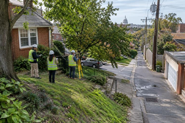
Reliable existing conditions information is the foundation of sound site planning. A current survey should establish property lines, visible improvements, grades, sidewalks, curbs, driveways, retaining walls, and known easements. Field review should also identify site details that may not be obvious on older drawings.
What to Review First
- Property boundaries, easements, and building restrictions.
- Existing grades, low points, downspout outlets, and drainage paths.
- Driveways, alleys, sidewalks, curb cuts, and other public right-of-way conditions.
- Known utility locations and probable service connections.
- Existing trees, canopy spread, and likely root protection areas.
- Soil conditions, ponding concerns, and possible flood-related constraints.
- Nearby structures, walls, fences, and drainage features that may affect the work.
Visible conditions do not always show underground utilities, buried drainage connections, or legal limitations on a parcel. Confirming the baseline conditions before finalizing a layout helps the team distinguish between a workable plan and a plan based on assumptions.
Build Stormwater Control Into the Layout
Roofs, patios, driveways, and compacted soil can change how rainfall moves through a property. Planning for runoff after the building footprint, parking, and paving are fixed usually leaves fewer options. By contrast, an early layout can reserve practical locations for planting areas, storage, conveyance, and maintenance access.
Stormwater Questions to Ask
- Where does water travel during a heavy storm?
- Can runoff be managed close to the roof or paved surface where it begins?
- Is there enough room for utilities, planting, overflow paths, and maintenance?
- Will construction damage or compact areas intended to absorb water?
- Who will inspect and maintain the completed system?
Protect Trees From the First Sketch
Mature trees are not simply landscape features to address at the end of the design. Their trunks, branches, roots, and protection areas can affect building placement, excavation, paving, grading, and staging. A driveway or utility trench shifted during concept planning may avoid root disturbance that would be difficult to resolve later.
Tree Planning Steps
- Locate trees on the property and near the proposed work area.
- Record their species, size, condition, and relationship to the limits of disturbance.
- Identify trees that may be subject to District requirements.
- Reserve protection areas before locating trenches, equipment routes, or material storage.
- Coordinate tree protection with final grading and drainage details.
- Show fencing and protective measures clearly in the construction documents.
Preserving suitable trees can retain shade, support neighborhood character, and help maintain planted areas that receive and slow rainfall. Tree protection is most effective when it is paired with a realistic construction plan, rather than relying on notes added after site logistics are already decided.
Map the Permit Path
One project can involve more than one review path. Building permits, land disturbance controls, stormwater management, utility work, public space occupancy, and tree-related work may each require different information or approvals. Listing those paths early helps establish responsibilities and prevents late changes to drawings.
For work that affects sidewalks, alleys, roadways, tree spaces, or other District-owned areas, public-space uses may require a permit. This is particularly important when construction needs temporary sidewalk occupancy, traffic control, curb work, or access through an alley.
Permit Planning Questions
- Which agency reviews each portion of the proposed work?
- Are separate submissions needed for public space, stormwater, tree, or utility impacts?
- What must be shown on the drawings for each review?
- Could a change in grading or access trigger additional coordination?
- Who will respond to review comments and update the plan set?
Plan for Construction Activity
A finished site plan is only part of the picture. During construction, exposed soil can erode, vehicles can damage roots, materials can block drainage paths, and temporary work can affect pedestrians or neighbors. A written sequence should show when tree fencing, sediment controls, temporary drainage measures, grading, and permanent stormwater features will be installed.
Construction documents should also identify access routes, stabilized entrances, material storage areas, inlet protection, inspection duties, and the person responsible for maintaining temporary controls. Those details help translate design intent into work that can be carried out safely on a constrained DC site.
Common Planning Mistakes
- Finalizing the building footprint before reviewing grades and drainage.
- Waiting until late design to assess trees and root protection areas.
- Assuming a single permit covers all construction-related activities.
- Providing stormwater features without access for inspection or maintenance.
- Routing utilities through tree roots or planned stormwater facilities.
- Overlooking sidewalks, alleys, and other public-space constraints.
- Using older guidance without confirming current District requirements.
Final Thoughts
Smart site planning in Washington, DC, is a coordination exercise. The best outcomes consider water, trees, grades, utilities, public space, permits, and construction activity together from the start. That disciplined approach can support a smoother review process, reduce field conflicts, and create a site that continues to function well after construction is complete.