For riders heading out from Fort Collins or Northern Colorado, Easy, Moderate or Difficult is often one of the first things they notice on a trail map.
Those labels are useful for narrowing down options, but they do not tell the whole story. Two routes rated Moderate can feel very different. One may follow mostly wide gravel roads, while another packs steep climbs, rocky sections and narrow terrain into the same rating.
For anyone planning to ride an electric dirt bike in a legal OHV area, the terrain, distance and current trail conditions behind the rating matter more than the label itself.
A Difficulty Rating Is Only the First Filter
Whether you are using COTREX or another trail resource, treat the difficulty rating as a starting point. The route description and current conditions provide the context that the label cannot.
Kelly Flats is a good example. This COTREX Featured Route in Northern Colorado is rated Difficult and runs 10.5 miles with 2,887 feet of elevation gain. But one of its biggest challenges comes early. About half a mile from the start, Heart Attack Hill presents a steep, loose climb. Beyond that section, much of the route becomes easier, although riders can also choose to take on The Chutes. Wet weather can make the trail extremely muddy as well.
So “Difficult” tells you to take the route seriously. It does not tell you where the hardest section begins, how long it lasts or what the ground will look like that day.
A Short Route Is Not Necessarily an Easy One
A trail that covers only a few miles can look like the easier option on a map.
That is not always the case. A short route that gains elevation quickly and includes rocks, ruts and repeated turns may concentrate more technical terrain into a smaller area. A longer route made up mostly of wide, relatively smooth surfaces may demand less technical riding.
Distance mainly affects riding time, physical effort and energy planning. Terrain adds another layer by determining how much control and experience the route requires. The two need to be considered together.
A map that says 5 miles or 10 miles is telling you how far the route goes, not how easy it will be.
Elevation Gain Only Tells Part of the Story
Colorado trails often involve significant elevation changes, but total elevation gain is still just one number.
A long, gradual climb feels very different from a slope that suddenly becomes steep and covered in loose rock, even if the overall elevation gain is similar.
When riding an electric motorcycle off-road, elevation gain should be considered alongside grade, surface and trail width. If a route includes substantial climbing, check whether those sections are narrow or loose and whether larger rocks or other obstacles appear along the way.
The elevation figure tells you how much climbing is involved. The route description gets closer to explaining why that climb may be difficult.
Surface Details Can Be More Useful Than the Rating
Once you are on the trail, you are no longer riding on a word such as Moderate or Difficult. You are dealing with whatever is under the tires.
Hard pack, loose rock, mud, roots, ruts and ledges can create very different conditions. The weather can change them again. Dirt that is fairly predictable when dry may develop deep ruts after rain, while higher-elevation routes can be affected by snow as the seasons change.
If a trail description includes words such as rocky, steep, narrow or muddy, pay attention. Those details often reveal more about the actual challenge than the difficulty rating alone.
They tell you what makes the route difficult instead of simply telling you that it is difficult.
Trail Difficulty Also Depends on the Rider and the Bike
Once you understand the distance, climbs and surface conditions, the next question is whether the bike fits those conditions. The goal is not to find the biggest number on a specification sheet. It is to understand how the overall setup relates to the route.
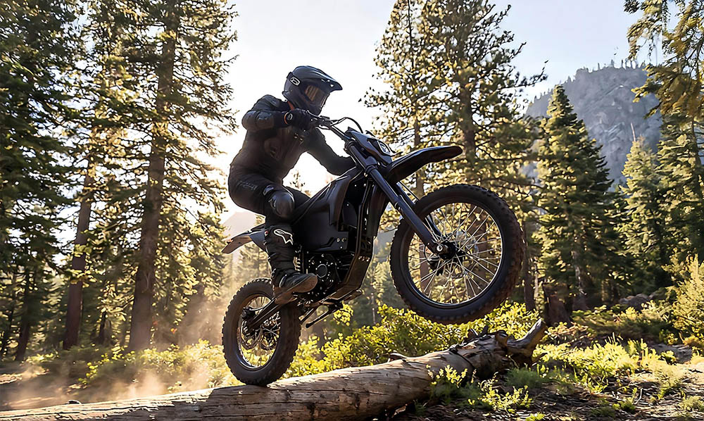
Repeated rocks and ruts can make wheel setup, suspension and stability more relevant. Longer routes or sustained climbs bring power delivery and usable range into the picture. On narrower trails with frequent turns, bike size and how naturally the rider can control it also affect the experience.
That is why adult riders comparing the best electric dirt bike for adults should not use peak power alone to decide what kind of terrain a bike suits. Qronge X5 Spark, for example, uses a 19-inch front wheel, a 16-inch rear wheel and 6000W peak power. Those specifications still need to be considered alongside rider size, route distance and real terrain such as rocks and climbs.
The trail rating answers one question: how challenging might the route be? Bike fit answers another: does this setup make sense for the rider’s current experience and the terrain ahead?
Judge Today’s Trail, Not Your Last Ride
It is easy to compare every new route with one you have already completed.
Finishing a Difficult trail before does not mean a Moderate trail should automatically feel manageable today. Routes earn their ratings for different reasons, and rain, snow, surface damage or temporary closures can change even familiar terrain.
If conditions are not right, choosing a legal route that better matches current experience and trail conditions makes more sense than forcing the original plan.
Before leaving, check COTREX or the appropriate land management agency for current trail status, permitted motorized uses and any required OHV registration or permit. Colorado Parks and Wildlife includes dirt bikes under its OHV rules and requires applicable registration or permits for use on relevant public-land roads and designated OHV routes. CPW also recommends COTREX for finding motorized trails.
Let the Rating Tell You What to Check Next
Easy, Moderate and Difficult are most useful when they point you toward the next questions rather than making the decision for you.
After checking the rating, look at distance, elevation gain, surface conditions, technical sections and current conditions. Confirm that the route is open to the appropriate motorized vehicles, then consider whether your experience and bike match what lies ahead.
For riders around Fort Collins and across Colorado, that approach also fits the area’s broader outdoor culture: enjoy the trail while respecting the environment, the rules and your own limits. Collegian coverage of CSU’s outdoor culture has similarly emphasized both participation in Colorado recreation and responsible use of outdoor spaces.
A difficulty rating on a map is only the starting point. What determines whether a trail makes sense that day is the grade, surface, distance and weather behind that rating — and how prepared the rider is to handle them.